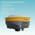
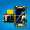
| Model: | V30 |
|---|---|
| Brand: | Gold |
| Origin: | Made In China |
| Category: | Electronics & Electricity / Telecommunication & Broadcasting / GPS |
| Label: | gnss rtk , rtk gps survey , rtk survey |
| Price: |
US $10
/ set
|
| Min. Order: | 1 set |
Product Description
Main Applications:
1. Construction Layout
2. Electric power transportation
3. CORS application
4. CORS site
5. Control survey
6. Data collection
7. Water Measurement
8. Construction Positioning (water)
Main Features:
Multi-constellation tracking
1. This RTK GPS has 220 tracking channels.
2. Supports GPS, GLONASS, GALILEO, BDS, SBAS.
3. NGS approved GNSS antenna.
Intelligent operation
1. Equipped with a smart speaker guiding the whole operation.
2. Multi one-button functions make fieldwork easier, such as auto
base setup by one button, the rover can get fix solution once it
is turned on.
Diversify RTK application
Optional transceiver UHF radio
1. The transceiver UHF radio enables the working mode to be
switchable between base and rover.
2. 2-watt HI-TARGET internal UHF radio and 2-watt Pacific Crest
TrimTalk© internal UHF radio are optional. Pacific Crest TrimTalk©
internal UHF radio is compatible with other radios.
3. Removable internal UHF radio enables users to fix or exchange
simply.
Seamless operation in CORS system
4.Built-in GPRS/GSM/3G module ensures that the V30 works
perfectly with network RTK positioning.
Long-life battery
1. Powered by 5000mAh Li-ion battery.
2. Static working time 13 - 15 hours.
3. RTK Rover (UHF/GPRS/GSM) working time 10 - 12 hours.
4. RTK Base working time 8 - 10 hours.
R ed and unique design
1. IP67 dust/water protection.
2. Withstands 3-meter natural fall onto concrete.
3. Rapid tracking and perfect avoidance or reduction of obstruction
and multipath effect to ensure superior positioning capability.
Main Specification:
| Channel | 220 | |
| Signal tracking | GPS | L1 C/A, L2E, L2C, L5 |
| Glonass | L1C/A, L1P, L2C/A, L2P | |
| SBAS | L1C/A, L5 | |
| BDS | B1,B2 | |
| Bluetooth | YES | |
| Positioning accuracy |
Static and Fast Static GNSS surveying Horizontal: ±(2.5mm+1ppm RMS); Vertical: ±(5mm+1ppm RMS) |
|
|
Post processing Kinematic(PPK/Stop & Go)GNSS surveying Horizontal: ±(1cm+1ppm RMS); Vertical: ±(2.5cm+1ppm RMS) Initialization time: typical 10 minutes for base while 5 minutes for rover Initialization reliability:typical>99.9% |
||
| Baseline length |
Static: 30-40km for low latitude area; up to 100km Fast Static: <20km; Stop & Go: <20km; PPK: <15km |
|
| Data storage | 1GB | |
| Data download | COM/USB | |
| Interval | 1s-60s adjustable | |
| Elevation | 1°-60° adjustable | |
| Data update rate | 1-50hz | |
| Communications | 2 RS-232 port; 1 USB port; 1 bluetooth port; 2 external DC power input port | |
| Dimension | 19.5cm * h10.4cm | |
| Weight (with battery) | 1.3kg (incl.battery) | |
| Water/dust proof | IP67, 3m(9.84ft) natural fall onto concrete | |
| Working temperature | -40℃~+65℃ | |
| Storage temperature | -40℃~+75℃ | |
| Electrical
|
2 pcs 7.4v 5000mAh lithium battery, supports 6-28v external DC power supply | |
| Power consumption 3.2W | ||
| Working time 13-15 hours | ||
| Software | Relevant software provided | |
Member Information
| CQ Gold M&E Equipment Co.,Ltd | |
|---|---|
| Country/Region: | Chong Qin - China |
| Business Nature: | Manufacturer |
| Phone: | 22982462 |
| Contact: | Gold Tao (Sales manager) |
| Last Online: | 05 Nov, 2015 |


